Pages

American Southwest 2007 - Grand Canyon North Rim

And onward...

Bryce Canyon seems to be the point at which I simply got tired of writing, as the diary ends there. However, the trip continued. After enjoying the amazing scenery at Bryce, we drove through Zion National Park. One thing that makes Zion different from some of the other parks is that, rather than driving around the top and looking out and down, one drives around the bottom, looking up. So, despite the intense heat and sun, we drove with the top down. Hot and red-faced, we exited the park and stopped at a shop in Springville to get some cold drinks and replenish our supply of ice in the cooler. Then we stopped for a quick visit with my friends Andrei and Nida, who run a cute bed-and-breakfast (the Amber Inn in Rockville) near the park.

Our plan was to go to the North Rim of the Grand Canyon the next day. The road is not as well-traveled as that in the south, and there aren't as many places to stay along the way. We were able to get a reservation at Jacob Lake Inn, about a 40-minute drive from the canyon. In the morning we drove to the canyon and spent most of the day driving to the view points and taking nature walks. Many people rave about the North Rim as being much, much better than the South Rim. Certainly there are differences, in that the surrounding area is much greener, the area is a cooler (although at this time of year the difference in temperature was not really significant) and it's less crowded. Maybe we were jaded from having seen so many rocks, cliffs, and canyons by the time we got here. But, specatctular though it was, we didn't really find this side to be "better" than the other. (And it was on the other side that we saw those condors.) We came back to Jacob's Lake to sleep, and in the morning packed up to head for Las Vegas.

The road approaching the Grand Canyon's North Rim passes through green meadows and woods,
very different from the sand and rocks that characterize the entrance to the South Rim.

There was also evidence of recent fires.

Rosemary took a lot of sky pictures on this trip. It's not always so blue back home!

The topography viewed at the north Rim is similar to that at the South Rim, but sometimes with more greenery.

The top of this natural arch is a spectacular viewpoint.


American Southwest 2007 - Bryce Canyon

Tuesday, June 12

Early in the morning we headed for Bryce Canyon National Park. We followed the recommended plan, stopping at all the view points in the park, which took about four hours.

Geology, weathering and erosion have sculpted huge, fascinating shapes in these natural amphitheaters.

These unusual pillars are called "hoodoos". According to the Auto Club book, the Indians had a name
for this area that meant "red rocks standing like men in a bowl-shaped canyon". That's a good description.

Everywhere we looked in Bryce, there was something spectacular to see. We took lots of photos.

We saw many mule deer in Bryce.

The most common cause of death in Bryce Canyon is heart attack.
(Falling off a cliff is second.) Here, rescuers carry out a man who
collapsed on the trail, probably from heat exhaustion. The last time
we saw him, he was sitting up and chatting with the paramedics.

Early settler Ebenezer Bryce said this would be "a hell of a place to lose a cow".

Rosemary poses with the scenery.
It looks as though Bryce had some snowfall, but this is just
the color of the mineral deposits at the top of these formations.

This sign explains that we are not on solid ground.


American Southwest 2007 - Taos and More

Sunday, June 10, 2007

We continued to Taos, where we walked around the Plaza and nearby tourist area, with lunch at Doc Martin's. Then we drove to the Taos Pueblo, a traditional village. This is a real community of about 150 people. One way they earn income is to charge admission (plus a photography surcharge) to tourists. Many of the people also sell arts and crafts. Some old structures here may be as much as 1000 years old, but most appear to have been remodeled or rebuilt in recent times. Nevertheless, the appearance of the village has changed little in the 500 years since the Spanish arrived. It is a great place to take pictures and think about life.

[Steve: Seeing the Native Americans at Taos Pueblo was a bit depressing. Imagine creating artwork just so that you could sit all day in the heat (either outside or in one of the adobe houses) waiting for tourists to buy your work. Maybe it’s middle class guilt, but we didn’t really bargain with any of the Native Americans selling their artwork and crafts anywhere we went (although if you hesitated in the slightest, they offered to lower the price), as we figured they could use the extra $5.00 more than us.]

We made a reservation for a motel in Durango, Colorado, and began our long drive. As the elevation increased, the scenery became increasingly green and fresh. There were farms and lovely pastures with grazing animals. We even saw snow on the ground as we passed through some mountains. It was quite a contrast to the harsh desert conditions we had experienced just a few hours earlier.

Monday, June 11

We got up early and drove to Mesa Verde National Park. It was a 15-mile drive just to get from the park entrance to the visitor center. After studying the maps and literature, we realized that we simply couldn't afford to spend the time it would take to explore this park. We ate lunch there and then left.

We stopped briefly at Four Corners Monument. This is the only place in the U.S. where the borders of four states meet (Colorado, Utah, New Mexico and Arizona). There is a photo-op plaque on the ground, where people can pose with their bodies in all four states at once while being photographed from the observation platform. The area is circled by small booths where Navajo vendors sell jewelry and crafts. There is nothing else there, or anywhere near there.

[Steve: A recurring theme of the trip was the periodic signs indicating that we were entering an Indian reservation. But even without the signs, you could tell: if there was a desolate, dry, dusty, lifeless, godforsaken piece of land, the next thing you saw was that sign. Man, did those people get screwed!]

From Four Corners, we had a long drive through more desert scenery: mesas, cliffs, mountains, sand, cactus, etc. We stopped for pictures at Glen Canyon Dam on the Colorado River. More red rocks! This is at the southern tip of the vast Glen Canyon National Recreation Area which surrounds Lake Powell (the lake created by the dam). We stopped to eat and then kept on going until, finally, we reached Ruby's Inn, just outside Bryce Canyon National Park.

Although not a town, Ruby's appears on road maps as if it were one. At this location since 1923, it has its own post office, gas stations, Utah state liquor store, car rental agency, shopping, swimming, laundromats, and foreign currency exchange. Hundreds of tourists (many arriving on huge bus tours) are served every day in its restaurants. Other than the lodges inside the park, there is no place to stay closer to Bryce.

[Steve: Ruby’s is quite the place. Their restaurant, where you can either order off the menu or go to the buffet (the overwhelmingly popular choice), feeds 600-700 people per meal. When we were there for dinner, a busload of Germans unloaded and, while their bags were being taken to their rooms, they descended on the buffet like locusts.]

About three miles north of the modern town of Taos is Taos Pueblo, home of the Taos Indians.

Although mostly built in modern times, their buildings are in the traditional style.

The traditional lifestyle is enhanced by modern transportation.

The Spanish mission was established around 1598, burned in 1680,
rebuilt about 1705, and finally destroyed in 1847. A few ruins and
a cemetery remain. This is the current church, a favorite with photographers.

The remains of the original bell tower stand in the old cemetery, which is still in use.

Driving through a small corner of Colorado, we achieved some elevation.

After days of sand and stone, snow was a welcome sight.

This lovely green landscape seemed remarkable after our trek across the desert.

We drove part way into Mesa Verde National Park.

At Four Corners, Steve covers four states: New Mexico, Colorado, Utah and Arizona.

We drove across this bridge next to Glen Canyon Dam


American Southwest 2007 - New Mexico

Friday, June 8

Driving toward Santa Fe, we decided to try the "Turquoise Trail", a side trip through some small towns known as artists' communities. We left the main highway and found ourselves on an unpaved county road flanked by ranchland, ten long, rough miles. [Steve: Truly a bone jarring ride, even at very slow speeds. And no cell service, so if we got stuck, we would have been out there for hours.] Eventually we emerge onto highway 14 and found our way to Madrid (pronounced MADrid by the locals) where we stopped for some gift shopping.

At Santa Fe, we checked into the El Dorado Hotel and then walked to the Plaza for lunch and sightseeing. The Plaza is surrounded on three sides by shops and on the fourth by the Palace of the Governors, which is now a museum. Around the edge of the Plaza and along the sidewalk in front of the palace, local artists and craftspeople set up tables or blankets from which they sell their wares. [Steve: Some of these people and their families have been doing this for years. We met one woman who had won the local art fair for over 20 years, only to lose one year to her daughter. She was proud, but still pissed.] Everyone who sells in this area has to be certified by the local government, so buyers can be assured that everything is authentic. This is a place to find plenty of turquoise and silver jewelry, as well as some pottery and other artworks or handicrafts. About a block from the Plaza is the Cathedral, built in 1869. Its stone architecture is a refreshing change from the ubiquitous Santa Fe style which is imposed on all contemporary buildings.

We learned that on certain nights, admission to several of the museums is free; this was one of those nights. We chose the Palace of the Governors, where we viewed a number of historical exhibits. Afterwards, we had dinner at The Old Room, the restaurant in our hotel. The El Dorado and its restaurant are often touted as the best in town (clearly they view themselves this way), and they are good, but for the price one could certainly do better. It's the kind of place that is expensive to begin with and then charges extra for every little thing. The service was not really first class (our room was not cleaned or made up, even though we spent two nights there). Although the food and service at the restaurant were good, the place we found our second night was much better.

Saturday, June 9

I was still sad about not having my digital camera, so we started the day by going to the local Best Buy and purchasing a camera. For unknown reasons, I had the idea that it would cost about $180 to get my previous camera fixed. The camera I bought cost $180. It didn't have as many features as the old camera, but it met my immediate needs, which included using the same kind of picture cards as the old camera. (I would later find out that my guess was right. When I got home, it cost me $180 to have the old camera repaired.)

We had to make another decision. Our original plan had been to drive as far as Denver or Boulder. But by now we could see that by covering such huge distances we simply wouldn't have enough time to see everything we wanted. So we agreed to forget the Rocky Mountains and spend another day in Santa Fe.

We spent most of the morning walking in the Canyon Drive area, a section of town that is filled with galleries and workshops. Then we drove a few miles out of town to the Shidoni sculpture garden. This is a huge outdoor gallery displaying large, bronze sculptures. On Saturdays, visitors can watch the bronze being poured in the foundry.

Back in town we looked in on more shops and galleries and visited the old Loretto Chapel with its famous "miraculous" staircase, a structure with no visible means of support [Steve: insert your own “brother in-law” joke here]. It began to rain in the afternoon, so instead of walking out for dinner, we drove to a very nice restaurant, La Casa Sena.

Sunday, June 10

We drove to Bandelier National Monument, a scenic, archaeological area known for its remains of ancient pueblos. The area was pleasant, with a small creek running through it and plenty of shade trees. Here we could get close to the ruins and, in some cases, climb inside them. This required negotiating some steep, narrow pathways and a few crude ladders. It was not too difficult, and was quite interesting. A longer hike to another site would have required climbing 140 feet up the cliff using ladders; we decided not to go there.

[Steve: Signs of civilization: graffiti inside the caves. What is it with some people?]

Santa Fe

This "shortcut" on the way to Santa Fe looked a lot better on the map.

On the way to Santa Fe, we stopped and shopped at Madrid (locals pronounce it
with the emphasis on the first syllable), a town on the "Turquoise Trail".

In Santa Fe, the streets leading to the plaza in the center of town are lined with shops.

The Cathedral Basilica of St. Francis of Assissi was built in 1869. Archbishop Lamy,
who inspired Willa Cather's novel Death Comes for the Archbishop, is buried here.

In front of the cathedral is a statue of Kateri Tekakwitha, the
first Native American to be beatified in the Catholic church.

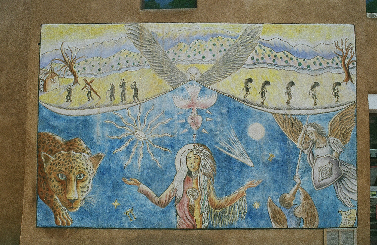
Civic art projects have encouraged student murals.

For decades, strict regulations in Santa Fe have required that
buildings conform to the "Santa Fe style" with its rounded edges and
limited color choices. The Inn and Spa at Loretto typifies this look.

The landmark Scottish Rite Temple, constructed in the early 20th
century, would never make it past today's building inspectors.

The Santa Fe River trickles through town.

Outside of town, we visited the Shidoni sculpture garden.

Bandelier National Park

Ancient Pueblo people lived in this area for several hundred years. The remains of many of their buildings can be visited.

This section was reminiscent of some of the ruins we had seen at Ostia Antica, outside Rome.

The foundations and some of the lower wall sections remain, but, like the Roman ruins, they have lost their roofs.

From the cliff, we can see the layout of the village.

Some inhabitants built multi-storied homes by using hand-carved caves that were reached with ladders.

Ladders placed by the park service allow tourists to peek inside.

The ground-level portion was built of stone.

This nearby, year-round stream made this a good place to live.

Subscribe


If you haven't already subscribed to this blog, here's how:

Enter your email address:

Delivered by FeedBurner


IMPORTANT: After you submit this form, you will receive an email asking you to activate your subscription. If you want to receive updates by email, you must click the activation link in the email.

Once you have activated your subscription, our blog posts will start arriving in your email inbox.

Thanks!